Using windows and viewports
To position content, GR and GKS perform a series of transformations from the coordinates you work with to the final coordinates on the screen or an image file.
The coordinates you work with can be in whatever range you want and are purely chosen by you. The space they lie in is usually called the world space. Maybe you do not want to include all of this world space in an image, but only a rectangular section of it. This section of world space that you are interested in is called the window and can be set using the setwindow function.
After selecting this window in world coordinates, you need to decide where it should be placed on your output image. For this, GR and GKS work with normalized device coordinates, with a range between 0 and 1 in both axes, with (0, 0) being the lower left corner and (1, 1) being the upper right corner of your output. The rectangular region in the output image onto which you want to draw the content inside your window is called the viewport. To set the viewport, you can use the setviewport function.
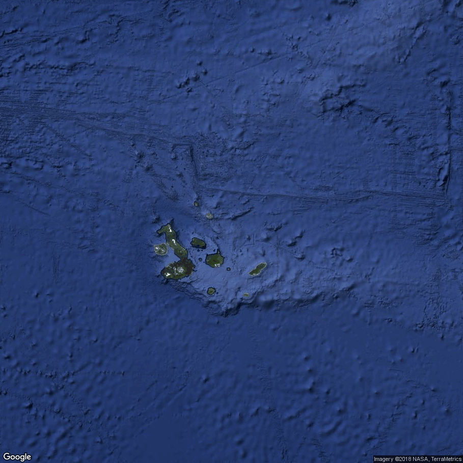
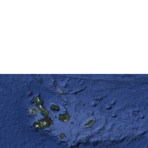
In the following example, we will use the window and viewport to position a satellite image of the Galapagos Archipelago, which is conveniently located at 0˚ latitude and -90˚ longitude, with the image capturing ±5˚ of both. We will use longitude as x coordinates and latitude as y coordinates in this example, thereby defining our world space. First, we open the image and read its width, height and pixel data:
import gr

width, height, image = gr.readimage("galapagos_example.png")
#include <gr.h>

/* ... */

int width = 0;
int height = 0;
int *image = NULL;
gr_readimage("galapagos_example.png", &width, &height, &image);
using GR

width, height, image = readimage("galapagos_example.png")
In the next step, we naively draw this image at its correct location:
gr.drawimage(-95, -85, -5, 5, width, height, image)
gr.updatews()
gr_drawimage(-95, -85, -5, 5, width, height, image, 0);
gr_updatews();
drawimage(-95, -85, -5, 5, width, height, image)
updatews()
The result? Nothing. The default window is set to [0, 1] × [0, 1] and therefore the image is not drawn. To mitigate this, we can use setwindow. With longitude ranging from -180 to 180 and latitude ranging from -90 to 90, we could do the following:
gr.setwindow(-180, 180, -90, 90)
gr.drawimage(-95, -85, -5, 5, width, height, image)
gr.updatews()
gr_setwindow(-180, 180, -90, 90);
gr_drawimage(-95, -85, -5, 5, width, height, image, 0);
gr_updatews();
setwindow(-180, 180, -90, 90)
drawimage(-95, -85, -5, 5, width, height, image)
updatews()
This results in a small blue rectangle where our satellite image is drawn, but it is far too small to work with. Instead of using all of earth as our window, you can focus on the region shown on the image by using a different set of parameters for setwindow:
gr.setwindow(-95, -85, -5, 5)
gr.drawimage(-95, -85, -5, 5, width, height, image)
gr.updatews()
gr_setwindow(-95, -85, -5, 5);
gr_drawimage(-95, -85, -5, 5, width, height, image, 0);
gr_updatews();
setwindow(-95, -85, -5, 5)
drawimage(-95, -85, -5, 5, width, height, image)
updatews()
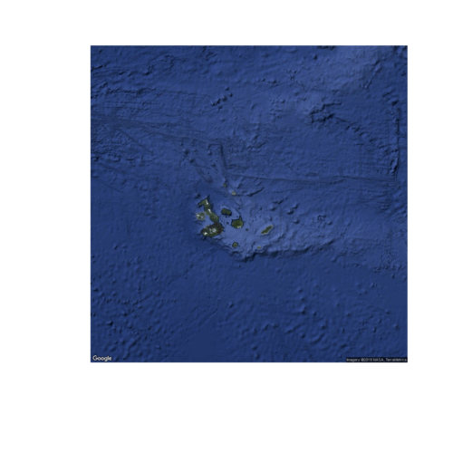
This way we can properly see the contents of the image, but with it containing ±5˚ longitude and latitude around the archipelago, we might adjust our window further to show only the region we are really interested in:
gr.setwindow(-92.75, -87.25, -1.75, 1)
gr.drawimage(-95, -85, -5, 5, width, height, image)
gr.updatews()
gr_setwindow(-92.75, -87.25, -1.75, 1);
gr_drawimage(-95, -85, -5, 5, width, height, image, 0);
gr_updatews();
setwindow(-92.75, -87.25, -1.75, 1)
drawimage(-95, -85, -5, 5, width, height, image)
updatews()
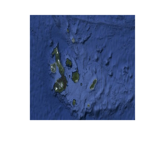
The window has a range of 5.5˚ latitude and 2.75˚ longitude, so it appears distorted when drawn as a square. Instead of using the default viewport, you can instead use setviewport to pick one that is shaped correctly and positioned to include the lower left corner of our output, (0, 0) in normalized device coordinates, and the middle of our output’s right side, (1, 0.5):
gr.setviewport(0, 1, 0, 0.5)
gr.setwindow(-92.75, -87.25, -1.75, 1)
gr.drawimage(-95, -85, -5, 5, width, height, image)
gr.updatews()
gr_setviewport(0, 1, 0, 0.5);
gr_setwindow(-92.75, -87.25, -1.75, 1);
gr_drawimage(-95, -85, -5, 5, width, height, image, 0);
gr_updatews();
setviewport(0, 1, 0, 0.5)
setwindow(-92.75, -87.25, -1.75, 1)
drawimage(-95, -85, -5, 5, width, height, image)
updatews()
To summarize: The window controls what region of your world space is drawn and the viewport controls which region of your output it is drawn on.